Departure

Arrival
The flight began with an enroute climb from 2,074 ft above sea level (asl) to the same altitude, resulting in no net gain in altitude. This climb phase lasted for 2 minutes and covered a distance of less than 1 nautical mile (nm). The aircraft then transitioned to an enroute level cruise, which started 1 mile west of Smrika in the Primorsko-Goranska Zupanija region of Croatia. This cruise phase lasted for 4 minutes and covered a distance of 1 nm.
The flight then entered another enroute climb phase, this time from overhead Jadranovo, where the aircraft climbed from 2,606 ft asl to 5,529 ft asl, an increase of 2,924 ft in 6 minutes. This climb phase covered a distance of 10 nm. Following this climb, the aircraft entered another enroute level cruise phase, which started 2 miles east of Bribir and lasted for 11 minutes. This cruise phase covered a distance of 28 nm.
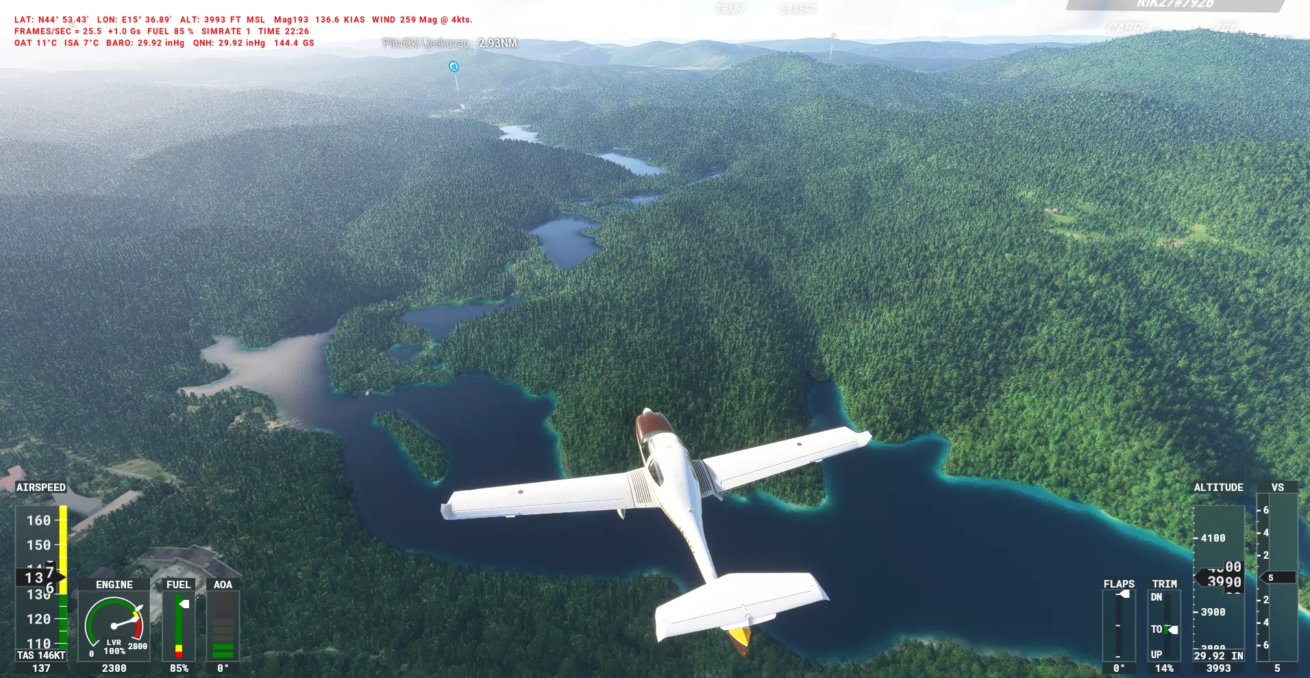
As the flight progressed, the aircraft entered an enroute descent phase from 6,008 ft asl to 3,992 ft asl, a decrease of 2,016 ft in 4 minutes. This descent phase covered a distance of 9 nm. The aircraft then entered another enroute level cruise phase, which started 1 mile north of Plitvicka Jezera and lasted for 4 minutes. This cruise phase covered a distance of 5 nm.
The flight then entered another enroute descent phase from 4,093 ft asl to 2,504 ft asl, a decrease of 1,588 ft in 4 minutes. This descent phase covered a distance of 8 nm. Following this descent, the aircraft entered another enroute level cruise phase, which started 1 mile north east of Covici and lasted for 9 minutes. This cruise phase covered a distance of 2 nm.
The final approach to runway 14 at LDRO Otočac Airfield was initiated from the north west, with a heading of 117.0° and an altitude of 389 ft above ground level (agl). The aircraft landed on the runway, which had a length of 1,598 meters. However, the threshold height was significantly above the target, and the threshold speed was too high at 97 knots.
The touchdown point was 116 meters beyond the touchdown zone, and the touchdown speed was excessively fast at 79 knots. The touchdown rate was fair at -286 feet per minute (fpm). Additionally, the runway touchdown position was slightly misaligned by 3.5 meters from the centreline. The local weather conditions were characterized by a temperature of 15°C, with a wind speed of 2 knots at 269°.
The total landing distance was 829 meters, which accounted for 52% of the runway length. The runway rollout alignment was also slightly misaligned by 14.6 meters from the centreline. The total flight distance was 65 nm, and the flight duration was 36 minutes. The aircraft used 15 kg of fuel during the flight.
Replay this flight in 3D — the full flight path over the terrain with every stage, event and score along the route.
Enroute Climb
100 %
Enroute climb started 1 mile west of Smrika (Primorsko-Goranska Zupanija, Croatia). Climbing from 2,074 ft asl to 2,074 ft asl, an increase of 0 ft in 2 minutes and covering less than 1 nm.
| Score | Description | Start | Profile | End |
| 100 % |
Average speed 115 kn 115 kn min to max 115 kn |
115 | 115 kn | |
| 100 % |
Average bank angle 0.7 ° 0.7 ° min to max 0.7 ° |
0.7 | 0.7 ° | |
| 100 % |
Average g force 0.98 g 0.98 g min to max 0.98 g |
0.98 | 0.98 g | |
| Info |
Average VSI 752 fpm 752 fpm min to max 752 fpm |
752 | 752 fpm | |
| Info |
Average altitude 2,074 ft asl 2,074 ft asl min to max 2,074 ft asl |
2,074 | 2,074 ft asl | |
| Info |
Average pitch angle 4.3 ° 4.3 ° min to max 4.3 ° |
4.3 | 4.3 ° | |
| Info |
Turn coordination 0 0 min to max 0 |
0 | 0 |
Enroute Level
100 %
Enroute level cruise started 1 mile west of Smrika (Primorsko-Goranska Zupanija, Croatia) and lasted 4 minutes, covering 1 nm.
| Score | Description | Start | Profile | End |
| 100 % |
Average altitude 2,102 ft asl 2,074 ft asl min to max 2,466 ft asl |
2,074 | 2,466 ft asl | |
| 100 % |
Average speed 115 kn 115 kn min to max 116 kn |
115 | 116 kn | |
| 100 % |
Average bank angle 0.8 ° 0.7 ° min to max 2.6 ° |
0.7 | 1.0 ° | |
| 100 % |
Average g force 0.98 g 0.98 g min to max 1.00 g |
0.98 | 1.00 g | |
| Info |
Turn coordination 0 0 min to max 0 |
0 | 0 | |
| Info |
Average pitch angle 4.2 ° 4.0 ° min to max 4.3 ° |
4.3 | 4.1 ° | |
| Info |
Battery Master On at 22:02:56 |
|||
| Info |
Engine 1 Started at 22:02:56 |
|||
| Info |
Beacon Lights Switched On at 22:02:56 |
|||
| Info |
Landing Lights Switched On at 22:02:56 |
|||
| Info |
Navigation Lights Switched On at 22:02:56 |
|||
| Info |
Strobe Lights Switched On at 22:02:56 |
|||
| Info |
Taxi Lights Switched On at 22:02:56 |
|||
| Info |
Autopilot Master Switched On at 22:02:56 |
|||
| Info |
Autopilot Flight Director Activated at 22:02:56 |
|||
| Info |
Landing Gear Down at 22:02:56 |
Enroute Climb 2
81.15 %
Enroute climb started overhead Jadranovo (Primorsko-Goranska Zupanija, Croatia). Climbing from 2,606 ft asl to 5,529 ft asl, an increase of 2,924 ft in 6 minutes and covering 10 nm.
| Score | Description | Start | Profile | End |
| 100 % |
Average speed 120 kn 106 kn min to max 130 kn |
116 | 126 kn | |
| 56.02 % |
Average bank angle 23.7 ° 0.0 ° min to max 62.0 ° |
0.3 | 21.1 ° | |
| 87.43 % |
Average g force 1.13 g 0.71 g min to max 1.94 g |
0.99 | 1.03 g | |
| Info |
Average VSI 450 fpm -940 fpm min to max 1,500 fpm |
856 | 333 fpm | |
| Info |
Average altitude 4,604 ft asl 2,606 ft asl min to max 5,575 ft asl |
2,606 | 5,529 ft asl | |
| Info |
Average pitch angle 2.9 ° -3.1 ° min to max 8.4 ° |
4.2 | 2.3 ° | |
| Info |
Turn coordination 0 0 min to max 0 |
0 | 0 | |
| Info |
Autopilot Altitude Hold Activated at 22:04:08 |
|||
| Info |
Autopilot Altitude Hold Deactivated at 22:04:19 |
|||
| Info |
Autopilot Vertical Hold Activated at 22:04:19 |
|||
| Info |
Autopilot Nav1 Lock Activated at 22:04:49 |
|||
| Info |
Autopilot Master Switched Off at 22:07:55 |
|||
| Info |
Autopilot Master Switched On at 22:08:45 |
|||
| Info |
Autopilot Master Switched Off at 22:08:49 |
|||
| Info |
Autopilot Master Switched On at 22:08:53 |
|||
| Info |
Autopilot Master Switched Off at 22:09:40 |
Enroute Level 2
91.42 %
Enroute level cruise started 2 miles east of Bribir (Primorsko-Goranska Zupanija, Croatia) and lasted 11 minutes, covering 28 nm.
| Score | Description | Start | Profile | End |
| 100 % |
Average altitude 5,845 ft asl 5,534 ft asl min to max 6,086 ft asl |
5,534 | 6,010 ft asl | |
| 100 % |
Average speed 131 kn 124 kn min to max 137 kn |
125 | 137 kn | |
| 81.56 % |
Average bank angle 11.0 ° 0.0 ° min to max 49.2 ° |
20.0 | 0.1 ° | |
| 88 % |
Average g force 1.04 g 0.73 g min to max 1.92 g |
1.03 | 1.02 g | |
| Info |
Turn coordination 0 0 min to max 0 |
0 | 0 | |
| Info |
Average pitch angle 0.3 ° -8.0 ° min to max 5.0 ° |
2.2 | -1.0 ° | |
| Info |
Autopilot Altitude Hold Activated at 22:11:38 |
|||
| Info |
Autopilot Vertical Hold Deactivated at 22:11:38 |
|||
| Info |
Autopilot Master Switched On at 22:12:12 |
Enroute Descent
100 %
Enroute descent started 5 miles south east of Plaski (Karlovac, Croatia). Descent from 6,008 ft asl to 3,992 ft asl, a decrease of 2,016 ft in 4 minutes and covering 9 nm.
| Score | Description | Start | Profile | End |
| 100 % |
Average speed 148 kn 137 kn min to max 150 kn |
137 | 137 kn | |
| 100 % |
Average bank angle 9.7 ° 0.0 ° min to max 20.9 ° |
0.0 | 0.1 ° | |
| 100 % |
Average g force 1.03 g 0.95 g min to max 1.11 g |
1.00 | 0.99 g | |
| Info |
Average VSI -564 fpm -740 fpm min to max 28 fpm |
-10 | -36 fpm | |
| Info |
Average altitude 4,475 ft asl 3,989 ft asl min to max 6,008 ft asl |
6,008 | 3,992 ft asl | |
| Info |
Average pitch angle -2.9 ° -3.7 ° min to max -0.6 ° |
-1.0 | -0.7 ° | |
| Info |
Turn coordination 0 0 min to max 0 |
0 | 0 | |
| Info |
Autopilot Altitude Hold Deactivated at 22:21:51 |
|||
| Info |
Autopilot Vertical Hold Activated at 22:21:51 |
|||
| Info |
Autopilot Altitude Hold Activated at 22:24:40 |
|||
| Info |
Autopilot Vertical Hold Deactivated at 22:24:40 |
Enroute Level 3
100 %
Enroute level cruise started 1 mile north of Plitvicka Jezera (Lika-Senj, Croatia) and lasted 4 minutes, covering 5 nm.
| Score | Description | Start | Profile | End |
| 100 % |
Average altitude 4,078 ft asl 3,988 ft asl min to max 4,284 ft asl |
3,991 | 4,093 ft asl | |
| 100 % |
Average speed 136 kn 119 kn min to max 139 kn |
137 | 139 kn | |
| 100 % |
Average bank angle 5.3 ° 0.0 ° min to max 20.3 ° |
0.1 | 3.6 ° | |
| 100 % |
Average g force 0.99 g 0.85 g min to max 1.23 g |
1.02 | 0.95 g | |
| Info |
Turn coordination 0 0 min to max 0 |
0 | 0 | |
| Info |
Average pitch angle -1.2 ° -3.0 ° min to max 6.2 ° |
-0.4 | -3.0 ° |
Enroute Descent 2
100 %
Enroute descent started 5 miles west of Plitvicka Jezera (Lika-Senj, Croatia). Descent from 4,093 ft asl to 2,504 ft asl, a decrease of 1,588 ft in 4 minutes and covering 8 nm.
| Score | Description | Start | Profile | End |
| 100 % |
Average speed 146 kn 135 kn min to max 157 kn |
139 | 144 kn | |
| 100 % |
Average bank angle 3.4 ° 0.0 ° min to max 22.1 ° |
3.6 | 8.5 ° | |
| 100 % |
Average g force 0.98 g 0.80 g min to max 1.36 g |
0.95 | 0.96 g | |
| Info |
Average VSI -604 fpm -1,544 fpm min to max 539 fpm |
-589 | -99 fpm | |
| Info |
Average altitude 3,273 ft asl 2,504 ft asl min to max 4,093 ft asl |
4,093 | 2,504 ft asl | |
| Info |
Average pitch angle -3.1 ° -6.9 ° min to max 2.0 ° |
-3.0 | -2.0 ° | |
| Info |
Turn coordination 0 0 min to max 0 |
0 | 0 | |
| Info |
Autopilot Master Switched Off at 22:30:22 |
|||
| Info |
Flaps Position 1 at 22:34:03 |
Enroute Level 4
84.22 %
Enroute level cruise started 1 mile north east of Covici (Lika-Senj, Croatia) and lasted 9 minutes, covering 2 nm.
| Score | Description | Start | Profile | End |
| 89.79 % |
Average altitude 2,168 ft asl 1,652 ft asl min to max 3,127 ft asl |
2,502 | 1,922 ft asl | |
| 100 % |
Average speed 103 kn 58 kn min to max 150 kn |
143 | 88 kn | |
| 70.78 % |
Average bank angle 11.5 ° 0.0 ° min to max 54.6 ° |
18.0 | 2.9 ° | |
| 89.71 % |
Average g force 1.10 g 0.14 g min to max 1.67 g |
0.92 | 0.39 g | |
| Info |
Turn coordination 0 0 min to max 0 |
0 | 0 | |
| Info |
Average pitch angle 0.3 ° -14.5 ° min to max 26.1 ° |
-3.1 | -5.3 ° | |
| Info |
Flaps Position 2 at 22:37:56 |
|||
| Info |
Stall Warning Activated at 22:42:20 |
|||
| Info |
Flaps Position 1 at 22:42:21 |
|||
| Info |
Stall Warning Deactivated at 22:42:22 |
|||
| Info |
Stall Warning Activated at 22:42:24 |
|||
| Info |
Stall Warning Deactivated at 22:42:26 |
|||
| Info |
Stall Warning Activated at 22:42:42 |
|||
| Info |
Stall Warning Deactivated at 22:42:43 |
Arrival Final 1
54.39 %
Approaching runway 14 at LDRO Otočac Airfield from 1 nm to 0 nm. Descent from 389 ft agl to 146 ft agl. A decrease of 244 ft in 12 seconds.
| Score | Description | Start | Profile | End |
| 51.54 % |
Approach angle 6.5 ° 5.9 ° min to max 6.8 ° Target 3.0 ° |
6.6 | 5.9 ° | |
| 100 % |
Average speed 100 kn 92 kn min to max 106 kn |
92 | 98 kn | |
| 0 % |
Heading variation -1.5 ° -5.1 ° min to max 1.5 ° |
-5.1 | 1.5 ° | |
| 20.42 % |
Average bank angle 15.0 ° 0.9 ° min to max 32.5 ° |
0.9 | 14.5 ° | |
| 100 % |
Average g force 1.02 g 0.61 g min to max 1.23 g |
0.61 | 1.05 g | |
| Info |
Average VSI -1,124 fpm -1,595 fpm min to max -556 fpm |
-556 | -1,595 fpm | |
| Info |
Average altitude 271 ft agl 146 ft agl min to max 389 ft agl |
389 | 146 ft agl | |
| Info |
Average pitch angle -7.3 ° -10.7 ° min to max -3.2 ° |
-8.7 | -9.1 ° | |
| Info |
Flaps Position 2 at 22:42:53 |
Arrival Landing
39.35 %
Landing on runway 14 at LDRO Otočac Airfield, runway length 1,598 m. Threshold height at 89 ft agl was significantly above target. Threshold speed was too high at 97 kn.
| Score | Description | Start | Profile | End |
| 52.87 % |
Threshold speed was too high at 97 kn. Target 75 kn |
|||
| 24.44 % |
Target 50 ft agl |
|||
| 0 % |
Landing and flare profile |
|||
| 59.6 % |
Heading variation 0.7 ° -0.1 ° min to max 1.5 ° |
1.5 | -0.1 ° | |
| 90.66 % |
Average bank angle 2.5 ° 0.0 ° min to max 5.7 ° |
5.7 | 2.2 ° | |
| 100 % |
Average g force 1.05 g 0.93 g min to max 1.29 g |
1.05 | 1.03 g | |
| Info |
Average speed 88 kn 79 kn min to max 97 kn |
97 | 79 kn | |
| Info |
Average VSI -558 fpm -1,607 fpm min to max -131 fpm |
-1,607 | -286 fpm | |
| Info |
Average altitude 31 ft agl 2 ft agl min to max 89 ft agl |
89 | 2 ft agl | |
| Info |
Average pitch angle -0.6 ° -7.8 ° min to max 1.6 ° |
-7.8 | 1.2 ° |
Arrival Touchdown
82.3 %
Touchdown point was 116 m beyond the touchdown zone. Touchdown speed at 79 kn was excessively fast. Touchdown rate was fair at -286 fpm. Runway touchdown position was slightly misaligned by 3.5 m from centreline. Local weather - Temperature 15 °C. Wind 2 kn at 269 °. Crosswind: 2 kn Tailwind: 1 kn.
| Score | Description | Start | Profile | End |
| 93.6 % |
Touchdown VSI was -286 fpm. |
|||
| 89.97 % |
Touchdown distance was 549 m Target 457 m |
|||
| 28.81 % |
Speed at touchdown 79 kn Target 57 kn |
|||
| 98.22 % |
Runway alignment max 3.54 m 2.90 m right |
-2.11 | -3.54 m | |
| 99.19 % |
Average bank angle 0.9 ° 0.3 ° min to max 2.2 ° |
2.2 | 0.3 ° | |
| 100 % |
Average g force 1.12 g 1.03 g min to max 1.18 g |
1.03 | 1.07 g | |
| 100 % |
Landing Bounce |
|||
| Info |
Average speed 78 kn 78 kn min to max 79 kn |
79 | 78 kn | |
| Info |
Average pitch angle 0.8 ° 0.6 ° min to max 1.2 ° |
1.2 | 0.8 ° |
Arrival Rollout
81.03 %
Total landing distance 829 m, 52 % of runway. Runway rollout alignment was slightly misaligned by 14.6 m from centreline.
| Score | Description | Start | Profile | End |
| 100 % |
Landing distance 829 m 52 % of runway. |
|||
| 57.83 % |
Runway alignment max 20.19 m 14.62 m left to 5.57 m right |
-3.69 | 14.62 m | |
| 100 % |
Average g force 1.01 g 0.94 g min to max 1.06 g |
1.06 | 1.00 g | |
| Info |
Average speed 75 kn 44 kn min to max 82 kn |
82 | 44 kn | |
| Info |
Average pitch angle 0.4 ° -1.0 ° min to max 1.9 ° |
1.1 | -0.5 ° | |
| Info |
Average bank angle 0.6 ° 0.0 ° min to max 2.1 ° |
0.2 | 0.1 ° |
Runway Exit
Exiting runway, average speed 14 kn
| Score | Description | Start | Profile | End |
| Info |
Average speed 15 kn 6 kn min to max 39 kn |
39 | 6 kn | |
| Info |
Average pitch angle -0.4 ° -1.1 ° min to max 0.5 ° |
-0.7 | -1.1 ° | |
| Info |
Average bank angle 0.2 ° 0.0 ° min to max 0.5 ° |
0.0 | 0.2 ° | |
| Info |
Average g force 1.00 g 0.99 g min to max 1.02 g |
0.99 | 1.00 g | |
| Info |
Flaps Fully Retracted at 22:43:30 |
The DA40-NG aircraft successfully landed at LDRO Otočac Airfield, but the landing was not without its issues. The final approach was initiated from the north-west, heading 117.0° at 0 nm and 389 ft above ground level (agl). The aircraft touched down on runway 14, which has a length of 1,598 m. However, the threshold height at 89 ft agl was significantly above the target, indicating that the aircraft may have been higher than desired at the point of touchdown.
Upon further analysis, it was found that the threshold speed was too high at 97 kn, which is above the recommended speed for landing. This could have contributed to the aircraft's excessive speed at touchdown, which was recorded at 79 kn. The touchdown rate of -286 fpm was fair, but the touchdown point was 116 m beyond the touchdown zone, indicating that the aircraft may have been slightly long on the landing.
The local weather conditions at the time of the landing were relatively calm, with a temperature of 15 °C and a wind speed of 2 kn at 269°. The crosswind component was minimal at 2 kn, and the tailwind component was even weaker at 1 kn. Despite these favorable conditions, the aircraft's landing performance was not optimal.
The total landing distance was 829 m, which is 52% of the runway length. This is a relatively long landing distance, indicating that the aircraft may have been traveling at a higher speed than necessary for a safe landing. The runway rollout alignment was also slightly misaligned by 14.6 m from the centreline, which could have contributed to the overall performance issues.
Overall, while the DA40-NG aircraft successfully landed at LDRO Otočac Airfield, there were several areas for improvement in terms of landing performance. The aircraft's speed and height at touchdown were both above target, and the landing distance was longer than desired. With some adjustments to the approach and landing technique, the pilot may be able to achieve a more optimal landing performance in the future.
Drag to zoom · double-click to reset · hover for values